Green Growth Plan (GGP)
For each landscape in Liberia, IDH engages a partner to develop a spatial development plan on county level. This high-level plan envisions the spatial development of a county in a sustainable and holistic way considering factors such as forests, agricultural spaces, and wildlife corridors. This should be a guideline for all future interventions or investments that influence the land use in the county. To work out this high-level plan, IDH engages a local partner to develop the Participatory Land Use Plan (PLUP) on district level, which is one administrative level lower than the county. As a result, the PLUP is more detailed and specific to district characteristics, taking into account water use, land cover by vegetation, cultural traditions, community facilities and market linkages.
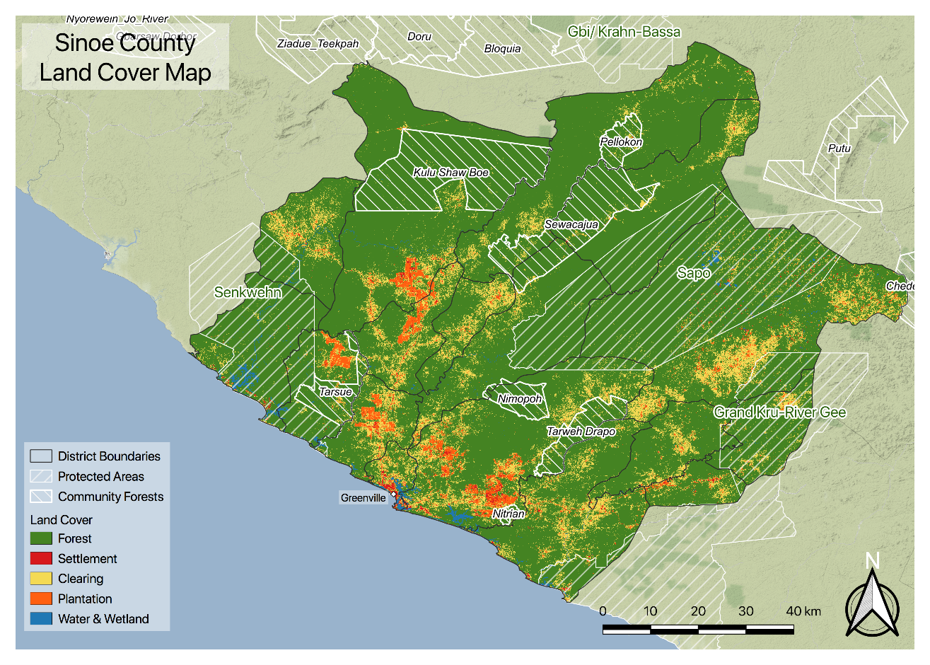
For the GGP in Sinoe, Liberia, the spatial development plan concluded:
- Sinoe has the highest forest cover in Liberia and high potential for effective management and development of forest resources. 85% of Sinoe County consists of primary forests.
- Closed canopy forest is an important reserve of carbon in Sinoe and should be properly managed to curb the release of carbon dioxide into the atmosphere
- Sinoe has a population of 124.976 inhabitants with high levels of absolute poverty (46%)
- The main food crops are rice (50%) and cassava (50%) while main cash crops at household level are plantain/banana (±5%), palm and coconuts. Main commercial crops are palm oil and rubber plantations (Beekman et al, 2017).
- There is limited marketing of farm produce, with only 17% of farmers selling part of their products
- The Sapo National Park (SNP) was the first official protected area in Liberia (1983). It is a priority conservation area for invertebrates, mammals, birds and reptiles
- There are also two Proposed Protected Area (PPA): Senkwehn PPA (808 km2) and Grand Kru – River Gee PPA (1337 km2 – partially in Sinoe)
- Several opportunities will allow Sinoe to further develop including to provide trainings on best and sustainable agricultural practices
Interested in learning more on the Green Growth Plan in Sinoe? Please contact the IDH Liberia team.
Participatory Land Use Planning in Southeastern Liberia
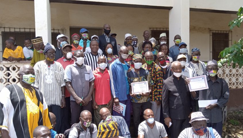
In 2019, the first Participatory Land Use Plan in Southeastern Liberia was developed with the people of Kpanyan Statutory district (within Sinoe County). The plan lays out the numerous factors of land use in Kpanyan, including:
- Biophysical characteristics of the district such as vegetation, soil types, climate, water ways, flora and fauna and crop capability
- Socio-economic characteristics such as demographics, income sources
- Cultural and governance characteristics, such as community forest, sacred forests and governance mechanisms in the district (on jurisdictional, communities and forests)
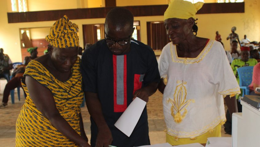
These factors are compiled and form a preliminary image of the current land use of the district. Hereafter, different stakeholders were invited to reflect on the land use plan of their district taking into consideration the biophysical situation, including its limitations and opportunities. When the draft PLUP is validated by the relevant stakeholders, the PLUP is finalized.
Following a break due to the Covid-19 pandemic, seven other districts in Southeastern Liberia including Wedcarba, Jedeppo, Dugbe, Jaedae, Putu and Chedepo completed their land use plans in 2022/ 23. These PLUPs together cover more than 700,000 hectares of land.
Communities to play a central role in forest management in Southeast Liberia
Out of the seven districts in Southeast Liberia, stakeholders from across four Statutory Districts signed Production Protection and Inclusion (PPI) Compacts covering an estimated 378,587 hectares of land, 85% of the total area is classified as “dense forest” under their land use plans. Through the compacts, stakeholders will commit to taking collective actions to better manage and protect their forest and natural resources. The signatory parties include the local government, women and youth leaders, community forest management bodies, community land development and management committees, private sector, and NGOs.
Publications
| Title | Type | Year | Regions | TAF |
|---|---|---|---|---|
| Case Study: Community-Driven Land Use in Liberia | Case Study | 2021 | - | - |
| IDH Liberia: Strengthening land governance, improving livelihoods and protecting forests | Brochure | 2020 | - | - |
| What communities should know about Liberia’s land rights law | Toolkit and guide | 2019 | - | - |
| Landscapes Information Brief: IDH’s approach to sustainable landscapes | Brochure | 2018 | - | - |
| Oil palm and forest protection with Golden Veroleum Liberia | Case Study | 2017 | - | - |
| Liberia Community Poster | Brochure | 2017 | - | - |
No publications found.

